Social Good: Students Create Tool to Address Economic Mobility

When streetlights burn out in the Enderly Park neighborhood, the darkness closes in, causing residents to worry about safety.
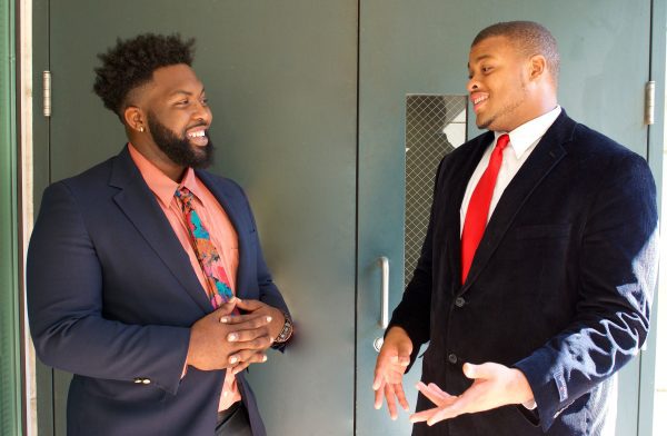
Neighborhood advocates may benefit from a new tool to help them push back the dark. UNC Charlotte geography undergraduate students Jamal Covington and Devin Martin have created a way for residents to use mobile devices to easily report issues such as burned-out lights.
Their design tied for first place in the Partnership for Social Good’s Hackathon in 2016. As a key element of UNC Charlotte’s Data Science Initiative, the partnership harnesses the university’s collective expertise and resources to collaborate with the community on potential solutions to complex social problems.
The hackathon challenged students to create an app or game for a mobile device to address the issue of economic mobility, defined by people’s ability to change their economic status. In a nationwide analysis of economic mobility, Charlotte ranked last among 50 major metropolitan areas studied.
“We tried to address this issue by creating a mobile mapping application powered by Geographic Information System technology that would plot out different physical issues, problems, and assets that could be recorded within the application,” Covington says.
The students focused specifically on the Enderly Park neighborhood in west Charlotte, a longtime partner with the Charlotte Action Research Project (CHARP), which is based at UNC Charlotte. The students began their project through the university’s Community Scholars Program, a summer research initiative focused on engaged scholarship.
“With our See My Voice project, we developed and tested the app and made revisions and technical tweaks as to how it would work, how data would be recorded, and what data exactly we would be looking to record,” Martin says.
The application works through the plotting of components found in the neighborhood.
“An example of this would be inadequate lighting at a bus stop,” Covington says. “This poses a safety risk for people using the buses to commute because of low visibility in these dark environments. The person using the app could record this issue by taking a photo using a mobile phone. A component point is then placed on the map to represent faulty lighting. The final step in the process could involve a company taking this data and finding a way to implement solar lighting infrastructure at the bus stop.”
Plans are to continue to fine-tune the app and make it available for use.
“We understand that the world is transforming and changing constantly,” Martin says. “These constant changes mean that the types of data that will be gathered and used will ultimately change. CHARP will have access to edit and revise the app to alter and manipulate how data is collected within the application.”
The students worked on the project with Department of Geography and Earth Sciences faculty members Laurie Garo and Janni Sorensen. “Our mentors are what we would like to call our unsung heroes,” Martin says. “Absolutely none of this could have been possible without them. They were constantly challenging us and pushing our minds daily to create something extraordinary that could be used to change and transform communities forever.”
The students’ studies in geography also played a significant role in their entrepreneurial work.
“Studying geography enabled us to observe how different components of our environment are connected,” Covington says. “Understanding connectivity between things that we all use and interact with on a daily basis allowed us to really put our creative thinking skills to work. We hope that this idea can be used as an instrument to create change in the world.”
Words and Image of Martin and Covington: Garland Beamer. Learn more about their project in this video.