From landslides to food deserts: How collaborative research propels communities and may help NC rebuild after Helene

Amid Hurricane Helene’s aftermath, an environmental research and technological powerhouse at UNC Charlotte is providing critical information for planning and rebuilding efforts.
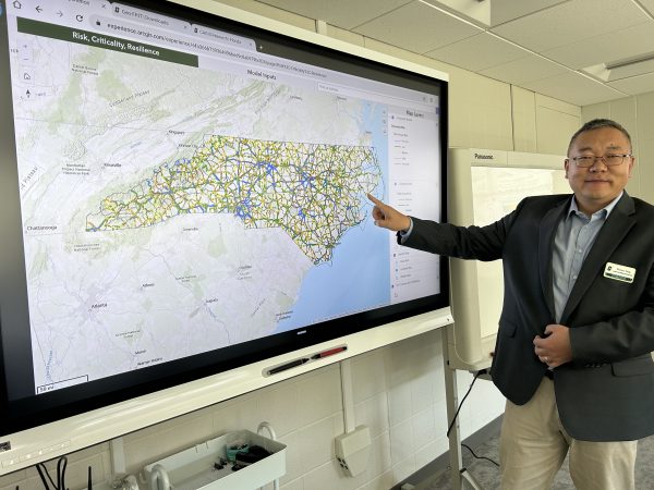
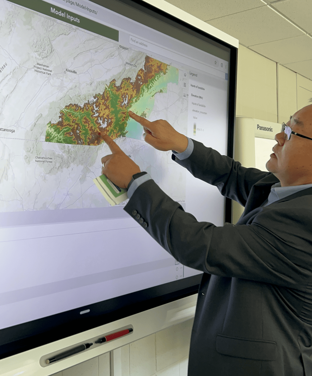
Recently unveiled research from the Center for Applied Geographic Information Science (CAGIS) details the now all-too-familiar threats of flooding and landslides in the North Carolina mountains, with particular emphasis on the increasing risks posed by hurricanes. The work – accessible through a new public-facing dashboard – represents years of research leveraging a century’s worth of data.
Behind the scenes, the center’s high-performance computational modeling allows policymakers and infrastructure leaders to analyze the combined risks to roads and bridges posed by large-scale disasters such as flooding, landslides, and wildfires.
“Fundamentally, we need to estimate or quantify the risk – for example, to transportation infrastructure – so this dashboard really came in time. It can be helpful for people who are impacted, for future for post-disaster management, and for planning and recovery of the communities in the area,” said Wenwu Tang, Ph.D., professor in the Department of Earth, Environmental and Geographical Sciences (EEGS), and Executive Director of CAGIS. Tang is the principal faculty involved in the new research.
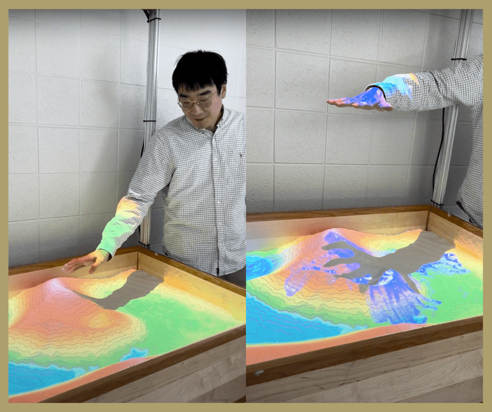
Inside CAGIS, faculty and students access supercomputing technology, sophisticated GIS mapping tools, and a deep bench of dynamic research infrastructure – from augmented reality to parallel computing architecture – to produce groundbreaking insights into extreme weather threats.

For the latest research on landslide risks to bridges in North Carolina’s mountain valleys, the research team also traveled to the region for field data, gathering measurements and observations from riverbeds, ridgetops, and bridge girders. The findings were published earlier this year in the peer-reviewed GeoHazards.
While Geo-FRIT, the new geospatial analytics tool for quantifying freight risk and resilience in transportation, was commissioned by the North Carolina Department of Transportation more than three years ago, the timing of the dashboard’s availability is especially poignant in the hurricane aftermath. In Western North Carolina, more than 115 people are estimated to have died during Hurricane Helene’s devastating march through the Southeast in late September. The combined threats of landslides/mudslides and waterways at historic flood stage left billions of dollars worth of damage to infrastructure alone. Rebuilding, officials have said, will take years.
“The recent publications from EEGS and dashboard from CAGIS illustrate how the College of Humanities & Earth and Social Sciences integrates our teaching and research into the actionable information our communities need to thrive, and in this case, recover,” said Chris Boyer, founding dean of the College of Humanities & Earth and Social Sciences (CHESS).
“In CHESS, we ask important questions and provide support for the pressing issues facing our world today, creating innovative ideas and holistic solutions to address the human and global impact of an ever-changing climate, community advocacy, and societal growth and wellness, while continually adapting those ideas for evolving conditions,” said Boyer.
Essential Real-World Research Shapes Communities
On campus and in the field, research teams from UNC Charlotte work year-round on projects like the Geo-FRIT dashboard. The department focuses intensely on research with real-world applications and the NCDOT-related dashboard showcases just one example of the university’s cutting-edge research.

From CAGIS to the Charlotte Action Research Project (CHARP) – both centers in EEGS – faculty tackle high-impact questions, assemble interdisciplinary experts, and produce actionable research.
“We’ve always been in the position to look at both the physical science aspect of a problem and the social science aspect of a problem,” said Sara Gagné, Ph.D., associate professor of landscape ecology, and department chair of EEGS. “We’ve had people looking at purely social science – for example, food insecurity in west Charlotte neighborhoods, and we have had people looking at purely physical science questions that ultimately can also help society – like how and why rock cracks in relation to climate change.”
“And as the decades have gone on, these major issues facing society have become more and more apparent and are having a real impact on people’s lives, so science has really moved into an era where interdisciplinary research, specifically combining the physical and social sciences, is essential – both to understanding and solving a problem,” said Gagné.
CHARP’s work, for instance, is instrumental to Mecklenburg County’s goal of addressing food access and health equity issues in and around Charlotte. Collaborating with government agencies, local residents, and faculty at Johnson C. Smith University, the project includes designing “a holistic food cooperative that could better respond to decades of disinvestment in food retail in West Charlotte.”

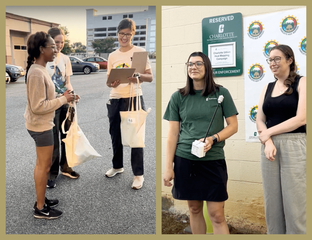
Research teams represent diverse backgrounds – from meteorology to urban planning and geography to environmental justice. Current CHARP projects range from mapping urban heat in Charlotte to providing recommendations for local leaders on 10-minute neighborhoods.
“For complex issues like that, you really need people to go out, collaborate with community members, and attend community meetings … to be able to hear their stories and put them in context,” Gagné said. In this way CHARP’s qualitative research methods provide real-world solutions, equipping decision-makers with information on “what works, what doesn’t, and why.”
On-the-ground, accessible science is part of what makes the research from CHESS stand out. For example, EEGS faculty have established the Redlair Observatory – a 1200 acre research site only 30 minutes from campus that is protected by and serving NC communities in understanding water, vegetation, land use and more.
The department also receives funding from two major National Science Foundation programs: Research Experiences for Undergraduates (NSF REU) and International Research Experiences for Students (IRES). This partially supports resources for undergraduate UNC Charlotte students to get involved right away with research in their major rather than opportunities that might only be available to graduate-level students.
“We have people that use a variety of different approaches to look at really critical issues facing people and the planet,” Gagné said.
Building State-of-the-Art GIS Technology
In CAGIS, the strength of the department’s investments in research technology is on full display.
For Tang’s work on infrastructure risk and resiliency, the research team layered technology tools to produce meaningful data, using supercomputers to drive the processing of multiple voluminous datasets and leveraging high-performance machine learning techniques to create unprecedented insights taking into account terrain, weather patterns, and the complexities of infrastructure conditions.
Combining measurements from scientists in the field with advanced technologies – such as drones, Light Detection and Ranging (LiDAR), Sound Navigation and Ranging (SONAR), and Global Navigation Satellite Systems (GNSS) – offers precise measurements to the centimeter or millimeter. This, joined with automated intelligence solutions, helps transportation planners by accurately classifying risk projections.

“The computing power and technology available in CAGIS is truly impressive, assembling researchers from across UNC Charlotte with expertise in issues of land, water, urban planning, engineering, weather, transportation, and of course, people,” said Boyer. “Our students and researchers use big data to develop and model scenarios that can have large implications for the future of our communities, not just in North Carolina, but across the world. They can examine the data in-house and produce visualizations that government agencies, industries and planners can use to make critical decisions.”
For Tang, this real-world impact is what motivates his work. “I’m proud that what I’ve been doing can be applied to help people. It’s meaningful for me in terms of scientific exploration. That’s really the outcome of the research – to bring benefit back to society. That’s really what the research means – to help people,” he said.
And, Tang explained, the work is ongoing. As roads are rebuilt and contemporaneous weather hazard data is added, researchers can perform updated analyses with the Geo-FRIT model.
“It’s about how we can monitor the status of the infrastructure over time,” he said. “So, for example, if we face this kind of extreme event, at least we know selectively what are those targets we need to pay more attention to and how to invest our resources in a more efficient manner.”